


You no longer want to unpack and repack your bags and load and unload the motorcycle.
You don't want to leave your family too far away.
The clover principle over 5 to 6 days 1 fixed point and different hikes every day.
The Aster Savoyarde is made for you, 1 week with 5 to 6 curls to choose from the catalog. On the menu of rolling, visits and tastings of local products…
Accommodation in a gîte or hotel... at your convenience.
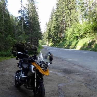
Motorcycle rental possible from my partners.
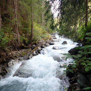
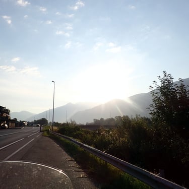
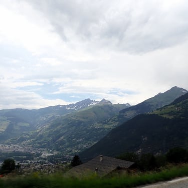
Visit the mountains and the great lakes of Hautes Savoie, tour Mont Blanc, ride mythical passes over 2000 m, visit the Vercors, the Chartreuse, the Belledonne, the Bauges...
Discover Savoyard culinary specialties (Wines, Cheeses, Liqueurs, etc.)
So come and browse the different loops offered.
Meet on Saturday at the accommodation for a welcome drink and choose the program according to your wishes and the weather.
Example of proposed program:
Day 1: A loop of approximately 135 to 350 km from more than 10 choices depending on your mood and the weather.
Day 2: A loop of approximately 135 to 350 km among more than 10 choices depending on your mood and the weather.
Days 3: A loop of approximately 135 to 350 km from more than 10 choices depending on your mood and the weather.
Day 4: Rest day. On the program: visits to cellars, cheese factories and other local tourist attractions, moments of relaxation...the choice is yours.
Day 5: A loop of approximately 135 to 350 km from more than 10 choices depending on your mood and the weather.
Day 6: A loop of approximately 135 to 350 km from more than 10 choices depending on your mood and the weather.
Here are the different loops where we can go:
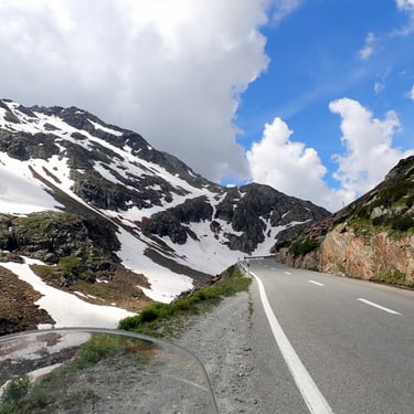
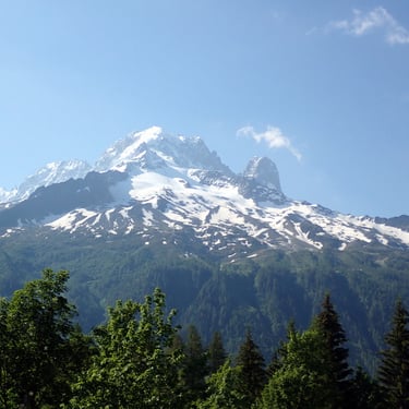
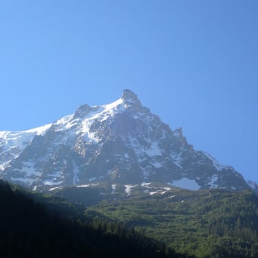
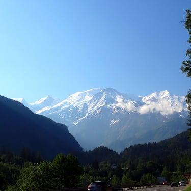
The Mont Blanc tour - around 330 to 360 km:
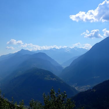
the longest but the most majestic, with the entrance to Beaufortain, the Col des Saisies (1633 m), the Chamonix valley with a view of the Aiguille du Midi, the sea of ice and the Bossons Glacier. Then pass to the Col de la Forclaz (1526 m), then Valais Switzerland via Martigny (CH). We will continue towards the Grand St Bernard pass (2469 m) via a little-known road, descent to Aosta (IT) with a lunch stop. We will follow the Aosta valley and then go up to the Petit St Bernard pass (2188 m).
Return to Bourg St Maurice and the Tarentaise valley.
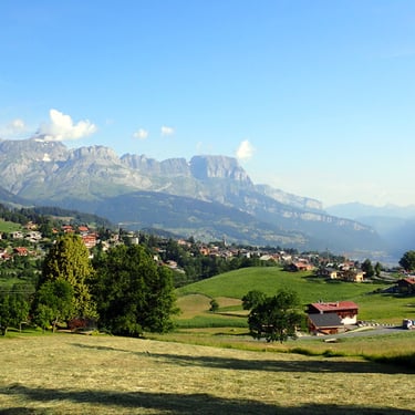
Around the Massif des Bauges - around 215 km:
The Bauges Regional Natural Park is classified as a UNESCO world heritage site and obtained the Géopark Label in 2011.
Departure towards Les Aillons with a stop at Chartreuse d’Aillon. The former monastery of the Carthusian order, located in the commune of Aillon le Jeune, is one of the oldest witnesses to the built heritage of the Heart of Bauges. (Visit possible depending on the dates) Then Stop at the Revard belvedere (1538 m) with its 360° view and its three pontoons above the void. This belvedere allows you to admire the Lac du Bourget, Aix Les Bains, the Dent du Chat but also the Mont Blanc…
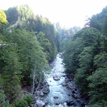
Then we will head towards the Abime bridge, between Cusy and Gruffy. The Abîme Bridge (built in 1887) is a suspension bridge with a span of 74.80 m which allows you to cross the Chéran at a height of 96 m.
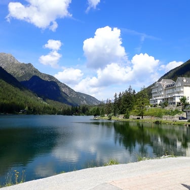
We will then take winding roads towards Semnoz (approx. 1600 m). Le Semnoz frames the west face of Lake Annecy. It offers a panoramic view of Lake Annecy, the mountains of the Bornes massif and the Bauges massif; and even Mont Blanc when the weather is clear.
A short trip to Lake Annecy where we will take a break for lunch.
After the meal, head to the heart of the Bauges via the Col de Leschaux, crossing Bellecombe en Bauges, Le Chatelard and Ecole en Bauges which is the “gateway” village to the National Hunting and Wildlife Reserve of the Bauges. Finally, we will leave the massif via the Col du Frêne (950 m)
The Bauges, Aravis and Beaufortain massifs - around 191 km:
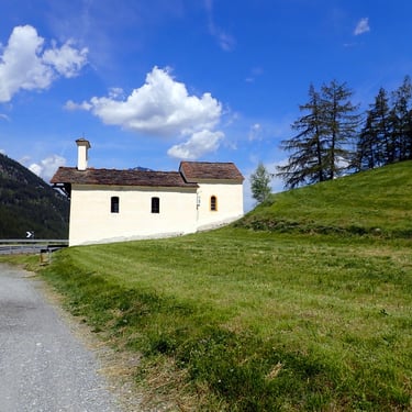
Passage by Fort Tamié (907m), the most important military monument of the Combe de Savoie (992m) with 16 hectares enclosed by a 1.8 km rampart. We will then stop at the Notre Dame de Tamié Abbey where you can buy the famous “Tamié” if you wish; Cheese made at the Abbey by Cistercian-Trappist monks since 1881.
Then direction the Aravis Massif where we will pass the Col des Aravis (1487 m) with a breathtaking landscape with a magnificent view of the Mont Blanc Range. The mountain pastures with the cows and their cows are typical of the pass.
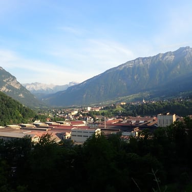
We will then go to the Col des Saisies (1633 m) to descend to Beaufort and its famous cheese. We will go back down through Albertville. We will make a final break to visit the medieval city of Conflans. Perched at the top of a rocky escarpment (412 m), medieval Conflans dominates the confluence of the Arly and the Isère. Throughout the centuries, sheltered behind its 14th century wall, it has kept its charm intact.
The Beaufort and Vanoise massifs - around 297 km:
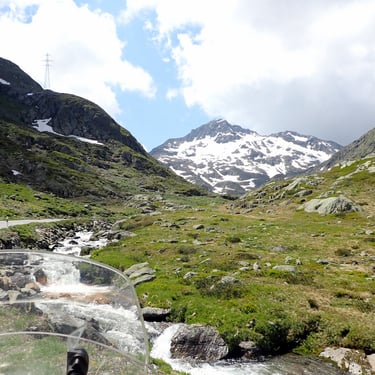
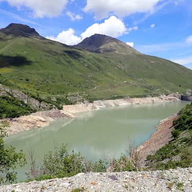
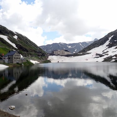
We will start this climb with the Beaufortain. This massif famous for its cheese and its various lakes. “Beaufort” cheese has been recognized as an AOP “Protected Designation of Origin” since 1968. Framed by massifs at more than 2800 m, we will access the Roselend dam and lake (1600 m) which in good weather is splendid with its turquoise waters . Then we will take the Cormet de Roselend (1967m). A big crush on this legendary Tour de France pass in the middle of the mountain pastures. This is the land of Beaufort and the cow bells ring in the distance.
We will make a stopover at the place called Les Chapieux or at the “city” of glaciers depending on the season.
Return to Bourg St Maurice for lunch.
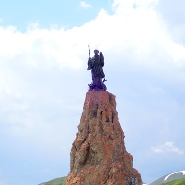
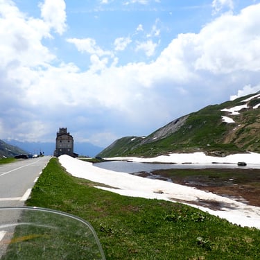
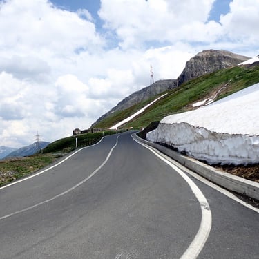
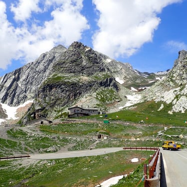
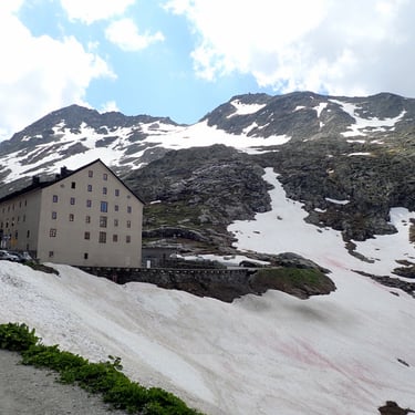
We will go up through the Vanoise massif, the resorts of Tignes and Val d'Isère to access the highest road mountain pass in all the Alps The Col de l'Iseran (2764m) - famous for the passage of the Tour de France .
We will go back down through the village of Bonneval sur Arc (1850 m). Last village witnessing authentic mountain habitat with its slate roofs.
On the return road, we will take the Maurienne valley where we can admire the military forts including Fort Marie Christine (1488m).
Bourget and Annecy lakes - around 180 km:
We will head towards Chambéry to take the west bank of Lac du Bourget, via the road overlooking the lake. We will head towards Hautecombe Abbey.
We will stop to admire and visit the Abbey. It overlooks Lake Bourget and houses the tombs of the illustrious Counts of Savoy, the last kings and queens of Italy.
We will head towards Lake Annecy via the Gorges du Fier.
We will stop at the foot of the Montrottier castle where we can eat and take a short digestive walk in the Gorges du Fiers. Remarkable natural curiosity of France with its very narrow and deep gorges which can be visited thanks to a footbridge fixed to the side of the rock, built in 1869 by the Annecy architect Marius Vallin and classified since 1943.
We will take the road again towards Lake Annecy. We will follow the lake towards Fort Tamié which we can visit. Fort de Tamié is the most important military monument in the Combe de Savoie (992m) with 16 hectares enclosed by a 1.8 km rampart.
We will also stop at the Notre Dame de Tamié Abbey where you can buy the famous “Tamié” if you wish; Cheese made at the Abbey by Cistercian-Trappist monks since 1881.
From there we will return to the starting point via the Combe de Savoie.
Visit to Chamonix via the Station des Saisies - around 227 km:
Departure from Combe de Savoie towards Val d’Arly. Come up from the Val d’Arly either via the gorges or via the ridges depending on the state of openness of the road.
Crossing Megève then direction Chamonix.
Depending on your preferences and the weather:
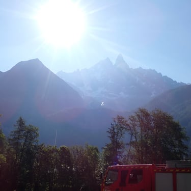
First subject: the gondola ride to the Aiguille du Midi (3777m) (reservation required) The Aiguille du Midi and its furnished terraces offer a 360° view of all the French, Swiss and Italian Alps. Thanks to an elevator, you access the summit terrace at 3842m, to discover a breathtaking view of Mont Blanc. On site you can see “THE STEP INTO THE VACUUM”
Thrill lovers will appreciate the site's new attraction... a technological feat and unforgettable sensations! More than a thousand meters of emptiness under your feet, in this glass box, glazed on 5 of its sides... A small step for the visitor, a big step in the history of the Aiguille du Midi! Thrills guaranteed.
Second subjection: “The famous little cogwheel train of Montenvers”. Departing from Chamonix, this train takes you to the Montenvers site located at 1913 m. A grandiose panorama of the Mer de Glace glacier, the Drus and the Grandes Jorasses.
On site visit the “ice cave”. A journey to the heart of the glacier, resized every year. It describes the life of mountain dwellers at the beginning of the 19th century. It is accessible either by a footpath, around a 20-minute walk, or by cable car: be careful, around 550 steps separate the arrival of the cable car from the entrance to the cave.
Continuation of the program: Walk in Chamonix then return with a break in the famous resort of Megève.
Descent from the Val d'Arly with a passage to the Col des Saisies (1657m) and descent to the Beaufortain. Possibility of going up to Beaufort to buy Beaufort “AOP cheese from the region”.
Return via Albertville for the end of the route.
The Chartreuse Massif, Lake Aiguebelette, around Lake Bourget and Revard - around 200 km:
Departure from the Combe de Savoie to climb to the Col du Granier (1134m) to descend into the Chartreuse Massif. We will take the road of the Guiers Vif gorges to arrive at Entre Deux Guiers and we will take other Gorges to arrive at Lake Aiguebelette.
Then head towards Lac du Bourget via Mont du Chat and we will take the Col du Chat road overlooking the lake. There, we will go towards Hautecombe Abbey.
We will stop to admire and visit the Abbey. The Abbey overlooks Lake Bourget and houses the tombs of the illustrious Counts of Savoy and the last kings and queens of Italy.
We will tour the lake passing through Aix les Bains before heading towards the Massif des Bauges. Finally stop at the Revard belvedere (1538 m) with its 360° view and its three pontoons above the void. This belvedere allows you to admire the Lac du Bourget, Aix Les Bains, the Dent du Chat but also the Mont Blanc…
From there we will descend towards the valley to return to the starting point.
The Chartreuse and Belledonne massif - around 160 km:
Departure from the Combe de Savoie to climb to the Col du Granier (1134m) to descend into the Chartreuse Massif. We will take the Guiers Vif gorges road to arrive at Entre Deux Guiers and we will take the Guiers Morts gorges. We will stop at the Grande Chartreuse Monastery Museum which we can visit. We will also be able to buy the famous Chartreuse liqueur and regional products in the museum shop. Since 1957, the Grande Chartreuse Museum's mission has been to bear witness to the life of the Carthusians. Indeed, if they are withdrawn to the bottom of the valley to find solitude and silence necessary for their contemplation, they cannot open the monastery to the public. This is the reason for the museum organized in the former house of the brothers, a real small monastery until the 17th century. Depending on the season, we can order a meal basket made up of regional products that we can enjoy on site.
Then we will go to Charmant Som (1660m) to enjoy the view of the Alps and the Chartreuse summits. We can also, depending on your wishes, plan lunch in an inn located at the foot of the mountain pasture.
From there, we will pass through the Col du Coq (1434 m) to head towards the Belledonne massif after crossing the Grésivaudan valley. We will go up through the foothills of the massif towards Allevard. We will finish our journey by the Breda narrows which will bring us back to our starting point.
The Vercors Massif - 280 km around:
Due to the distance, we will take the highway to Grenoble. Then we will enter the Vercors massif via St Nizier du Moucherotte. From there, we will head through the Bourne gorges towards the Choranche caves. This grandiose and dizzying route, classified 3 stars in the Michelin guide, is the longest of the typical routes of the Vercors. The road cut into the cliff was opened to traffic in 1872 after 11 years of work.
We can visit the Choranche caves (allow 1 hour). The cave is nestled in the exuberant nature of the Choranche cirque. Fistulous stalactites, veritable calcite straws, overlook underground lakes and rivers. The rooms of more than 30 meters in diameter and 15 meters in height allow remarkable underground perspectives! Hosted in the cave, we will be able to observe the Proteas: the largest predator of the underground universe. Measuring a maximum of 35 centimeters, this legendary cave animal, native to Slovenia, is most fascinating: blind, depigmented and capable of fasting for several months at a time.
Then we will go down to Pont en Royans for lunch and taste the Ravioles du Royans, a local specialty.
From there, we will go up into the massif either via the small gullies to head towards the Vassieu en Vercors Resistance Memorial (2nd World War) which we can visit, or we can go up via the Combes Laval cornice
We will take the return route via Rousset en Vercors and return to Grenoble via the Gorges du Furon
From there, we will return via the highway to our starting point.
On this route other visits are possible such as “the Magic of Automata” with its Santa Claus hamlet.
The Massif de Belledonne and Oisans passes - around 260 km:
We go up the Maurienne via the national road and then begin the climb towards the Col du Glandon (1924 m). We will take a break at the Col de la Croix de Fer to enjoy the view. From this legendary pass of the Tour de France, we will be able to see the Aiguilles d’Arves (3510 m) and the Pic de l’Étendard (3464 m). We will descend via the Maupas Défilé to join the Briançon road and the Lautaret pass in the Oisans Massif. This pass is also renowned by admirers of the Tour de France. From the Col du Lautaret, we will go to the Col du Galibier (2642 m), the 5th highest pass in the French Alps.
From the Col du Lautaret you can admire the La Meije range, to the south-east, that of Grand Galibier, to the north and several peaks of the Ecrins massif.
The Col du Galibier offers a breathtaking view of La Meije (3982m), the Guisane valley, high peaks such as the Barre des Ecrins (4102m), the Pelvoux (3946m) and even Mont Blanc (4810m). m) in good weather.
We will descend into the Maurienne valley via Valloire and the Col du Télégraphe (1566 m) to then return to our starting point by taking the valley of oils as you wish.
Visit Annecy - 135 km surroundings:
Annecy is a town in the Alps located in Hautes Savoie. This is where Lake Annecy flows into the Thiou. It is renowned for its old town with its cobbled streets, winding canals and pastel-colored houses, as well as its medieval castle.
I suggest you access it by crossing the Bauges. Then we can walk there and visit the old town and the banks of the lake. We will have lunch in one of the restaurants located along the canals.
We will then take the road overlooking the lake from the east bank. We will return via the Tamiè pass with its fort and its Abbey. We can stop at the Notre Dame de Tamié Abbey where you can buy the famous “Tamié” if you wish; Cheese made at the Abbey by Cistercian-Trappist monks since 1881.
Then we will return to our starting point.
Other variations of these routes are possible depending on your wishes, just ask.
Possibility of carrying out one or more loops outside of “Aster Savoyarde”, inquire.
The routes are mainly on secondary axes. Distances and routes are given for information purposes only.
Note* Asters are herbaceous plants and generally perennials
Guided motorcycle road trip
The Savoyard Aster *
Guided hikes 6/7 days on the road from Combe de Savoie


For other projects, contact me.
Copyright Fd Rando Organisation. Tous droits réservés.
Note aux utilisateurs : Les informations ci-dessus sont données à titre indicatif. Elles peuvent être inexactes ou modifiées à tout moment.
La responsabilité de Fd Rando Organisation ne peut être engagée en cas de pertes ou de dommages directs ou indirects liés à l’utilisation des itinéraires proposés, ou à l’impossibilité de les utiliser.
fdrando73@gmail.com
Tel: +33 (0)6 84 78 85 35
SIRET 880 034 426 00010