


Departing from Aiton (73) Distance: approximately 800 to 980 km following 4 or 5 days of hiking in 4 or 5 stages of more or less 200 km/day
Level: not recommended for beginner pilots
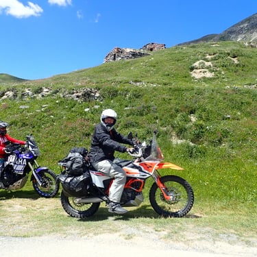
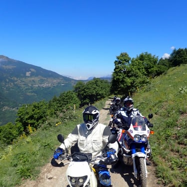
Capacity: 6 motorcycles maximum (route not suitable for passengers)
Decreasing price from 4 simultaneous registrations - Find out more!
Mixed hotel/bivouac accommodation (evening meal and breakfast nearby), possible in a hotel or gite only.
Possibility before departure to do a preparation day on the Savoyard slopes or to adapt the level of difficulty of this hike for a complete group – Contact me!
Program overview:
1° Day: Meeting 8:30 a.m. Departure 9 a.m. from the Tavern de l’arc in Aiton (73)
Direction Guillestre (05) Approx. 220 / 240 Km 60% of tracks and small roads.
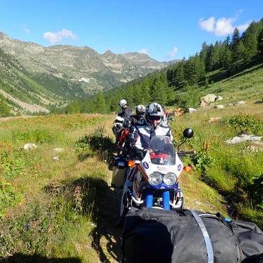
We will leave after the presentation and the small departure café, in the direction of Hautes Maurienne, we will take a few simple paths to test the group.
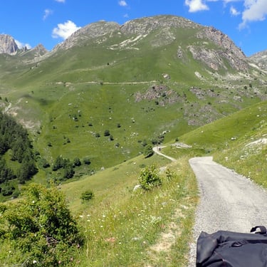
Then we will go towards Briançon taking a few tracks, then go to the Col du Lautaret. The route will be varied between small roads and tracks.
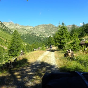
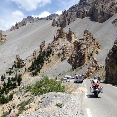
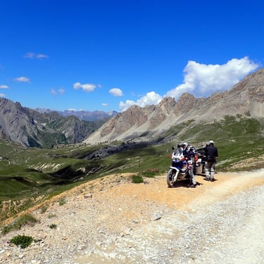
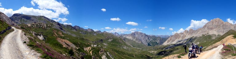
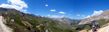
We will take trails at more than 2000 meters with sublime views of the massifs (La Meije, the Barre des écrins, etc.).
We will end the day on forest tracks among the fir trees, to arrive in Guillestre.
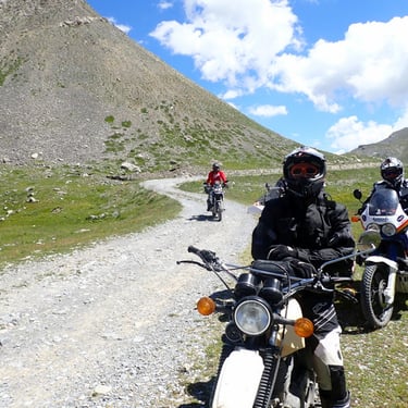
2° Day: departure around 8:30 a.m. towards the Col de la Bonette (2715m). Approx. 160 km 60/70% tracks and small roads.
After around twenty km of small roads and tracks, we will begin the climb via the tracks to the Parpaillon pass and tunnel (2780 m).
From there we will go back down to Jausiers (04) taking some little-known trails.
We will go to Barcelonnettes (04) and then take a small road in the Bachelard valley (Parc du Mercantour) towards the slopes which will allow us to reach the Col de la Bonette where we will make a photographic stopover.
We will go back down to Jausier taking a last track taking us to a lake reminiscent of “the little house on the prairie”.
3rd Day: departure at 8:30 a.m. towards Italy Approx. 200 km 50/60% tracks and small roads
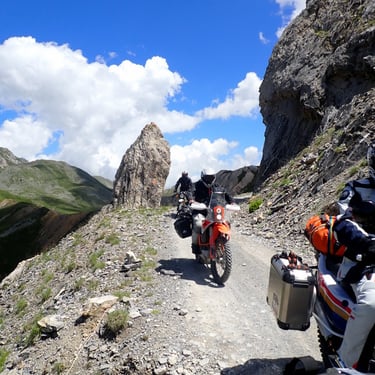
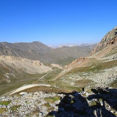
We will attack by the Col de Larche (or Madeleine) road and we will go down to Démonte (It), from there we will go by small roads and by military tracks towards Sampeyre (It), we will take passages at more than 2500 meters in an open mineral landscape that on certain days by motor vehicle, we will finish our descent to Sampeyre by a track on the mountainside with a breathtaking view of the Droneretto massifs and the Cuneo Valley (It)
4th Day: departure at 8:30 a.m. towards the Queyras massif Depending on the choice,
4 or 5 days. 2 different routes:
Choice 4 Days: Direction Aiton (73) Approx. 278 Km 50% tracks and small roads.
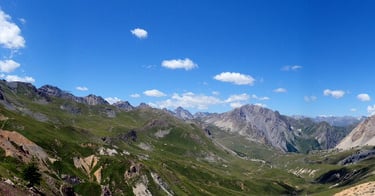
We take the road to return to France via the Col d'Agnel (2700 m), we enter the Queyras (05) where we will take a few tracks and small roads from time to time to reach Château Queyras, from there we will head towards the Col d'Izoard (2360 m) to arrive at Briançon, we will then head towards the Alpes d'Huez which we will reach by tracks and small roads with dizzying landscapes, we will head along high mountain lakes towards the Col du Glandon (1922m), we will finish with a few single tracks at the bottom of the Maurienne valley.
We will conclude the hike with a goodbye drink at the Taverne de l’Arc in Aiton (73).
Choice 5 Days: Direction Suza (It) Approx. 200 Km 60 to 70% tracks and small roads.
We take the road to return to France via the Col d'Agnel (2700 m), we enter the Queyras (05) where we will take a few tracks and small roads from time to time to reach Château Queyras, from there we will head towards the Col d'Izoard (2360 m) to arrive at Briançon.
We will head towards Italy via the Col de Montgenèvre and we will take tracks to reach Sestriere (It).
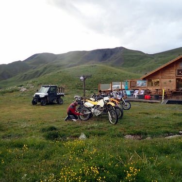
Stopover in a high-altitude hotel, before returning to the Assieta trail.
5th Day: Direction Col du Mont Cenis and La Savoie. Approx. 220 km 60% tracks and small roads In the morning, for more than 60 km, we will take the military track of the Assieta (Strada de l'Assieta) at an altitude of more than 2500 meters to continue via the Col de la Fenestre (Colle delle Finestre) where we will be able to cross road bikes on the track (stage of the Italian Giro).
At lunchtime we will make a well-deserved stopover in Suza(It).
Then, we will attack Mont Cenis (2085 m), we will begin the descent towards Modane via a series of tracks in the middle of the Sapins. We will descend the Maurienne Valley using a few trails, then we will head towards the Col de la Madeleine via the Montvernier bends and trails offering a final unforgettable panorama, we will descend into the Valley via forest trails and we will finish our GPA hikes in Aiton (73).
We will conclude the hike with a goodbye drink at the Taverne de l’Arc in Aiton (73).
Mark your calendars, don't forget to register quickly - Limited places!!
Guided motorcycle trail and maxi trail hike “the Great Tracks of the Alps” G.P.A.
From mid-July, 5-day hike possibilities 4 days departing from Aiton (73) for trail and Maxi trail.

For other projects, contact me.
Copyright Fd Rando Organisation. Tous droits réservés.
Note aux utilisateurs : Les informations ci-dessus sont données à titre indicatif. Elles peuvent être inexactes ou modifiées à tout moment.
La responsabilité de Fd Rando Organisation ne peut être engagée en cas de pertes ou de dommages directs ou indirects liés à l’utilisation des itinéraires proposés, ou à l’impossibilité de les utiliser.
fdrando73@gmail.com
Tel: +33 (0)6 84 78 85 35
SIRET 880 034 426 00010