


Departing from Aiton (73), to join the “HAUTE ROUTE DU SEL / ROUTE DES FORTS” (formerly the Amitié piste) located between Tende (Fr) and Limone (It) Distance: approximately 1300 km over 7 days of hiking approximately 200 km/day
Level: not recommended for beginner pilots
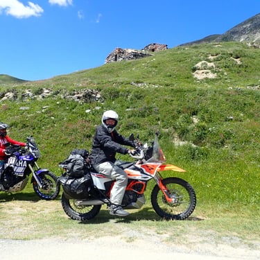
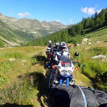
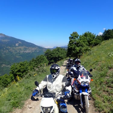
Capacity: 6 motorcycles maximum (route not suitable for passengers)
Decreasing price from 4 simultaneous registrations - Find out more!
Mixed hotel/bivouac accommodation (evening meal and breakfast nearby), possible in a hotel or gite only.
Possibility before departure to do a preparation day on the Savoyard slopes or to adapt the level of difficulty of this hike for a complete group – Contact me!
Program overview:
1st day: Saturday
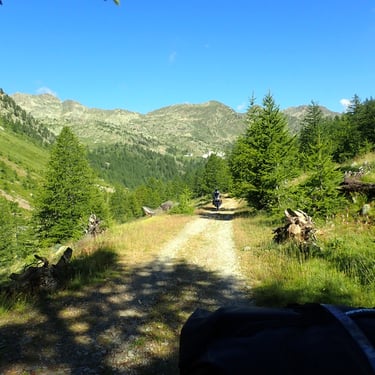
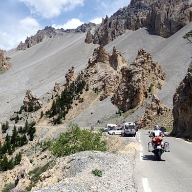
Approximately 235 km - 50% tracks -Departure at 9 a.m. from Aiton (73) -Ascend the Maurienne valley by roads and trails -Passage to the Col du Galibier (2642 m) and the Col du Lautaret (2058 m) -Descent towards Briançon taking a few tracks - arrival in the evening at Risoul station (05)
2nd day: Sunday
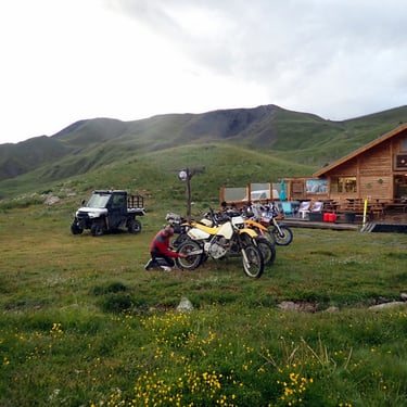
Approximately 165 km - 65% tracks - Departure from Risoul (05) towards the Col du Parpaillon (2640 m), subject to opening, crossing the legendary Parpaillon Tunnel which connects the Ubaye valley to Embrunais.
In case of closure, route via the Col de Vars (2108 m) - Direction Barcelonnette - Then head to the Col de la Bonette (2802 m), via the slopes or the road depending on the condition of the track, then climb to the pass. The highest paved road in Europe then bypasses the pass via a track to arrive in the evening at Saint Etienne de Tinée (06), a village in the Mercantour park.
3rd day: Monday
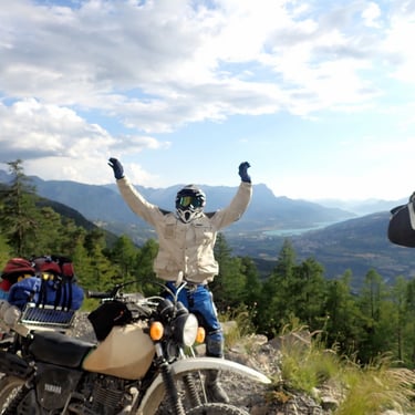
Around 185 km - 50% tracks - Direction Démonte (IT) via Isola and the Col de la Lombarde (2350 m), an Alpine border pass connecting the Tinée valley in the Maritime Alps to the Stura di Demonte valley, in Piedmont in Italy. - return to Isola (06) by tracks.
- Arrival in the evening at Saint Martin de Vésubie (06), nicknamed “the Switzerland of Nice”, at the gates of the Mercantour National Park.
4th day: Tuesday
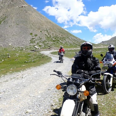
Approximately 128 km Km - 70% tracks
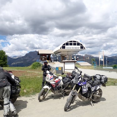
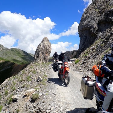
- passage of the Col de Turini (1607 m), famous for its special stage of the Monte Carlo Rally, then small road and track towards Tende (06), departure from the “Vallée des Merveilles”
- Arrival in the afternoon by a track passing by military forts overlooking Tende
– Final arriving in Tende via a section of the salt road.
- End of the afternoon: motorcycle service and rest in Tende (FR).
5th day: Wednesday
Approximately 190 km -80% tracks.
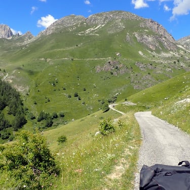
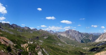
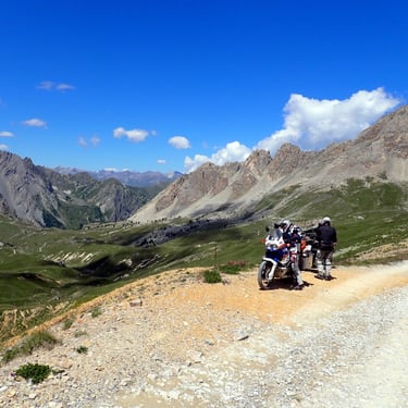
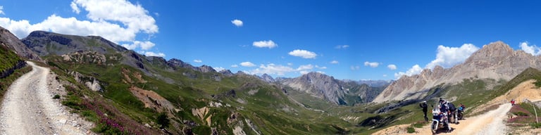
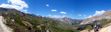
- Route of the “Haute Route du sel and Routes des Forts (formerly the Friendship Trail) at more than 2000 m
- Toll trail, allow €15 in cash. https://hauteroutedusel.fr/
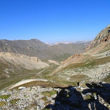
- Descent on limone (IT) and direction Canosio (IT) via a magnificent track at altitude at more than 2000 m.
- Bivouac recommended!
6th day: Thursday
Approximately 185 km Km - 70% tracks.
- Passage through the Col de Sampeyre (2284 m) (IT), then small road and track towards Paesana (IT). - Go up by small roads and tracks crossing the Infernotto valley and crossing the Rucas quarries (Pierre de Luserne) - Crossing Torre Pellice (IT) then going up the tracks to arrive at Fenestrelle (IT) which has the largest fortress in Europe which blocks the Fenestrelle valley 3km wide. 7th day: Friday Approximately 185 km - 50% slopes.
- Direction Col de la Fenestra (2178m) (IT) via the military fort tracks, descent to Suza (IT) via a famous Giro track with a final of 24 bends.
- Go up by road, then by an old military track towards the Lac du Mont Cenis (FR), descent to Termignon (FR) by a track. - Direction Aiton (73) via a road and a few track passages.
This information is given as an indication, depending on the weather, the state of the roads and tracks, the route may be adapted.
Mark your calendars, don't forget to register quickly - Limited places!!
Guided motorcycle trail and maxi trail hike “ Alta Via del sale” and “military fort road” French/Italian
From mid-July, 7-day hike from Aiton (73) for trail and Maxi trail.

For other projects, contact me.
Copyright Fd Rando Organisation. Tous droits réservés.
Note aux utilisateurs : Les informations ci-dessus sont données à titre indicatif. Elles peuvent être inexactes ou modifiées à tout moment.
La responsabilité de Fd Rando Organisation ne peut être engagée en cas de pertes ou de dommages directs ou indirects liés à l’utilisation des itinéraires proposés, ou à l’impossibilité de les utiliser.
fdrando73@gmail.com
Tel: +33 (0)6 84 78 85 35
SIRET 880 034 426 00010